Update 2 for ERDAS IMAGINE 2018 is now available to download. The major thrust of this release is enhancements to the machine learning capabilities but there are a lot of interesting new spatial modeler operators and other improvements and fixes as well.
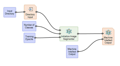
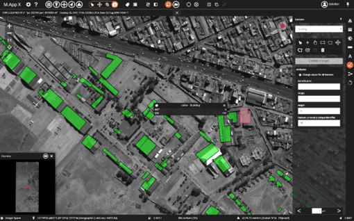
ERDAS IMAGINE has long had object based image analytical (OBIA) techniques, such as the Objective add-on. However, recent advances in deep learning have shown promising results over OBIA both in terms of ease of use and accuracy. In this release, deep learning operators have been added that learn from and perform object detection.
In order to access this functionality you will have to download the Spatial Modeler Deep Learning Expansion Pack from here: https://hexgeo.co/2E57nBM
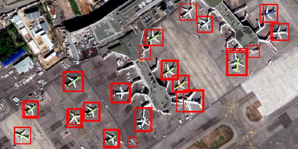
With this expansion pack, Faster R-CNN (Region-based Convolutional Neural Networks) is included and used as the algorithm for detecting objects. GPU acceleration is also supported on systems with the appropriate graphics card.
While the above is the highlight of this release, there are also a number of key new operators available in Spatial Modeler. Here at Geospatial Insight we have already found the suite of new feature operators incredibly useful for our own work flows – these include Join Features and Union Features along with the Define Functional Attribute. This now allows complex geo-processing to be performed and greatly enhances the ability to output useful and meaningful data.
As usual, there are new sensors that are supported (FORMOSAT-5, TripleSAT) and a raft of minor improvements and bug fixes. Useful to our United Kingdom customers is support for the OS OSTM15 model and the OSGM15 geoid. For a detailed overview of what’s new, here’s a link to the Hexagon document: bit.ly/ERDAS_2018_u2_doc
If you have any queries feel free to get in touch with us at support@geospatial-insight.com.
Find out more about Hexagon products on our dedicated webpages
.jpg)