BARELY HAVE WE INSTALLED UPDATE 2 OF ERDAS IMAGINE, RELEASED AT THE END OF LAST YEAR, WHEN IT'S TIME TO SAY HELLO TO UPDATE 3. WITH A SHORT GAP BETWEEN RELEASES , THERE CAN'T BE THAT MUCH NEW IN THIS ONE SURELY? WELL, YES AND NO.
Update 2 was a big update, with a lot of new functionality both on the Ribbon and in Spatial Modeler. Update 3 is more focussed, but with one stand out addition, which I’ll come to later.
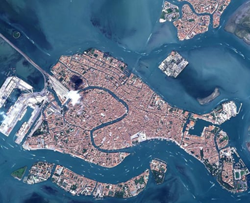
In Update 2, a wide range of new photogrammetry operators were added to Spatial Modeler. In Update 3, these are expanded to include satellite sensors via RPC and orbital pushbroom model support. Now a complete workflow can be created from ingestion of a satellite pair, through block creation, tie point creation, triangulation to output of an elevation dense point cloud and ortho images, all through Spatial Modeler.
Of course, there is additional sensor support (RADARSAT Constellation Mission, MAXAR Legion, ICEYE among others) and some handy additions such as an improved Mosaic and Point Input operator.
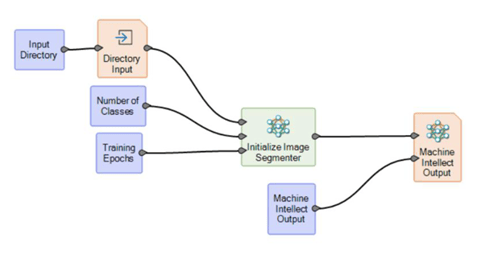
However, the really impressive addition to this update are the Artificial Intelligence Semantic Segmentation operators in Spatial Modeler. Semantic Segmentation is a term more commonly used in computer vision and is increasingly used in remote sensing. It is another term for the classical pixel level image classification in remote sensing. As such, all applications that start with image classification (e.g. land cover mapping, precision agriculture, and road network detection) will benefit from this deep learning-based approach to image classification.
The Image Segmenter is trained using example image tiles (approximately 224 x 224 pixels) with corresponding label images which show the class distribution in the training images.
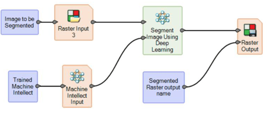
The operator performs semantic segmentation on the input raster and assigns a class and probability that the class is correct for each pixel. This is done using the trained deep learning-based image segmenter specified on the MachineIntellect port.
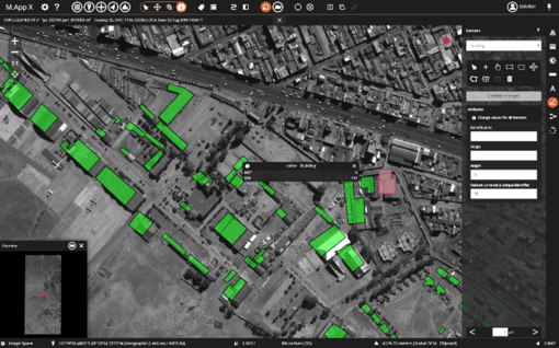
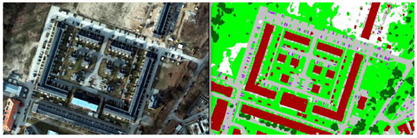
For example, the screenshots below show a multi-class semantic segmentation of satellite data to identify buildings, roads, etc.
As always, more information about all of the new technology can be found in the online Hexagon Geospatial help. Discussions and example Spatial Models can be found on the all new look Hexagon Geospatial Community. These are all definitely worth a look to gain tips and tricks to enhance your workflows.
This update also includes lots of behind-the-scenes enhancements and resolves a number of bugs. We urge all users to update to this version as soon as possible in order to take advantage of the new technology and stability features provided in this update.
If you would like further information about these new features or to arrange a technical call with our team please contact us at hello@geospatial-insight.com
.jpg)