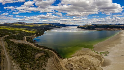
When the Australian state of Queensland was hit by an unprecedented period of monsoon rainfall, the threat of a major flood was high.
With the Townsville Ross River Dam level rapidly increasing during the evening of Sunday 3rd February a difficult decision was made to open the floodgates. This meant sacrificing properties in the city of Townsville to avoid a potential catastrophe, where devastation would be widespread if the dam were to burst. 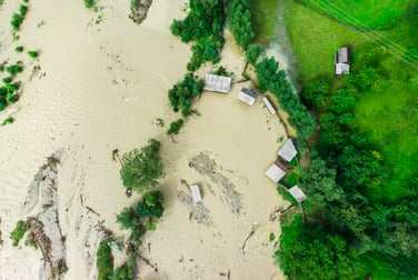
The resulting flooding was large enough for one of our major insurance clients to trigger our CAT response team. Remote Sensing analysts immediately sourced radar images and open source imagery captured on social media to aide initial extent mapping. After providing the client with an initial area of interest and flood extent boundary analysts set about using the acquired imagery to map the flood extent to a more granular level, ensuring both rapidity and accuracy.
The Geospatial Insight team were able to analyse terrain data with the already-established flood boundary to calculate flood depth. After calculation, these flood depth statistics could be used to provide initial loss assessment analysis for each property insured by the client.
Our proprietary cloud-based software enabled the insurer to view the visual evidence captured, which if required could have included damage analysis on a property-by-property basis.
The key advantage of utilising visual intelligence in a CAT response capacity is rapidity in analysis and delivery. As is often the case in the aftermath of a CAT event, access routes for loss adjusters are often blocked; visual intelligence can not only be used to identify their optimum route in but also to conduct building assessments to aide their work. With the availability and quality of visual intelligence derived insights ever-increasing the potential value of building information outputs becomes an increasingly lucrative data source for (re)insurers.
Insurers can register to put us on CAT Standby here info.geospatial-insight.com/catresponse
.jpg)