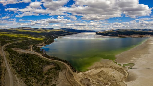
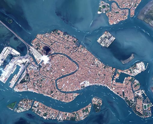
Using a data-driven approach, is there another way to gather up-to-date information without putting the person at risk? In scientific terms, “Remote sensing is the process of detecting and monitoring the physical characteristics of an area or object by measuring its reflected and emitted radiation at a distance”. In practice, this means gathering images from satellites, drones or aircraft and analysing this data to detect, scope and quantify. New studies indicate photos taken both on the ground and using unmanned aerial vehicles (UAV) can be used to create accurate 3D models which when merged with satellite data can be used for a variety of purposes.
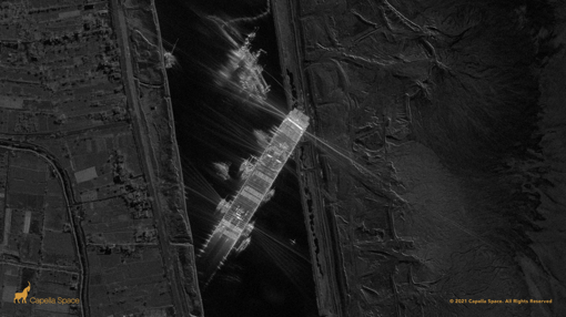
Until recently, using this approach was difficult, with only a limited numbers of relevant satellites in orbit that could be drawn upon, limitations on the commercial use of drones and the need to analyse the imagery only by using skilled human interpreters. That has all changed however – there are now more than 350 satellites in orbit providing detailed imagery, meaning that at least 25 imaging attempts per day will be made for every point on the Earth’s surface. Also, drones are now a ubiquitous tool, and in most countries, legislation has kept pace with technology to mean that they can be deployed, safely and legally, to capture high resolution images and videos. Crucially, rapid advances in AI technology mean that relevant information can now be extracted automatically from the images, allowing valuable insights to be garnered within seconds of an image being received, rather than having to wait for hours or days as was previously the case.
The US Military states “Joint forces require the ability to rapidly respond to threats around the world. Geospatial intelligence (GEOINT) supports this requirement by providing imagery, imagery intelligence (IMINT), geo-referenced data, and products (e.g., maps, charts, and elevation or vector information) that serve as a foundation and common frame of reference for any joint operation”. Remote Sensing and the processing and analysis of that data is now integral to military operations.
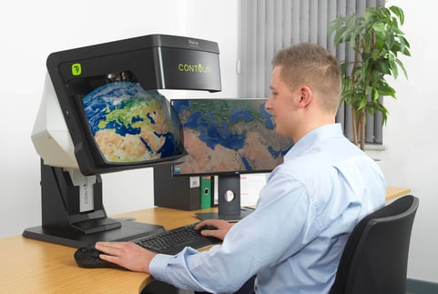
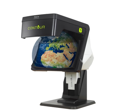
Remote Sensing data as a source of actionable intelligence is crucial to modern operations, both small and large. Imagery analysis has always produced better results when viewed in 3D thereby adding depth and context to the flat image. The next generation display technology provided by Vision Engineering’s CONTOUR system delivers a unique combination of image clarity, brightness and consistency in 3D without the need for specialist glasses. CONTOUR can be used to communicate high resolution stereo images to third party colleagues and specialist analysts across multiple locations, nationally and internationally, in real time. Military operators both tactically deployed and at base can work jointly on extracting intelligence from imagery from varying stereo image data sources.
To summarise, military operations have always been driven by intelligence and today, vast amounts of data can be accessed easily both in the field and elsewhere. Hardware and software tools are assisting in accessing this data, processing it through defined workflows and displaying the value added to the commander to aid decision making. Data-driven GEOINT is now an integral part of warfare.
The Hexagon Geospatial product portfolios have always provided sophisticated image analysis capability. Now, with the advent of cloud-based systems; M.App Enterprise and M.App X users can create applications to meet their specific needs and requirements, for example military personnel in the field can import and process data to directly update database records, providing the real-time intelligence required by the Commander.
Established Hexagon Geospatial software, ERDAS IMAGINE, works in unison with the next generation CONTOUR display technology to offer the most powerful partnership for 3D analysis. Geospatial Insight is the UK distributor for both of these technologies - contact our sales team at hello@geospatial-insight.com to discover how this partnership can benefit you.