Geospatial Insight is delighted to announce that our brand new Breathe Clean application is being trialled in Bicester for the next two weeks. In partnership with Cherwell District Council and the UK Space Agency’s Space for Smarter Government programme Geospatial Insight is the lead on the project that aims to use satellite imagery to monitor urban air pollution.
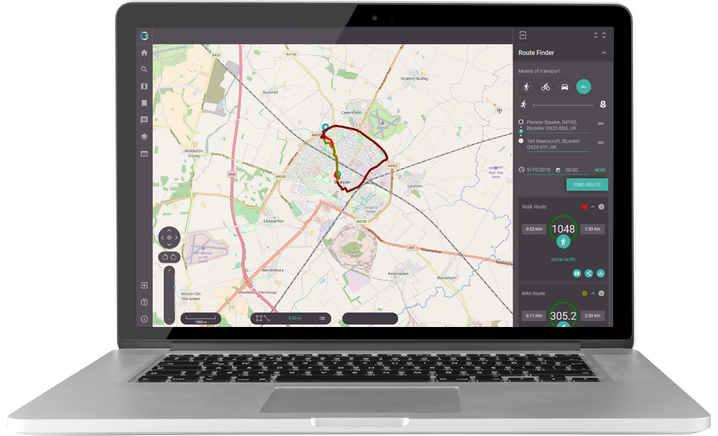
Breathe Clean has been developed to be used by councils across the country in a town planning capacity, for use in the transport, urban, commercial and community sectors. Councils will be able to benefit from a variety of features including a heatmap, date option, exposure levels, share route, save route, downloading and analysing data, and choosing a mode of transport. This project demonstrates a number of Geospatial Insight’s key technical and visual capabilities including virtual mapping, production of desktop and mobile applications and the processing of data from various sources.
“We are delighted to have created an interactive application that uses satellite imagery to monitor the effects of different modes of transport on air pollution levels in Bicester. This project serves as a demonstration of how the innovative uses of satellite technologies can be applied to combat global issues, and yet to help the individual too”
Dave Fox CEO Geospatial Insight
Whilst the UK government often considers the air pollution from a national perspective, Breathe Clean localises air pollution and traffic data to raise awareness of how individual actions can make a big difference. Awareness and understanding are two of the key pillars upon which this project is built - in this regard Breathe Clean provides an interactive interface to allow users to plan and compare different routes based on mode of transport and their subsequent exposure levels to air pollution. The interface allows users to select and compare the fastest and least polluted routes in Bicester.
Sara Huntingdon, Space for Smarter Government Programme Manager, said: “Satellites are a vital part of our daily lives and measuring air quality is one of their many uses. Combining satellite data with other ground-based monitoring sensors is revolutionising how we make sense of the world around us to improve life on Earth.
The UK Space Agency’s Space for Smarter Government Programme is proud to be supporting the innovative Breathe Clean project, working with Geospatial Insight and Cherwell District Council, to help improve health outcomes for residents. We hope the success of this project will help influence future planning within local and national government.”
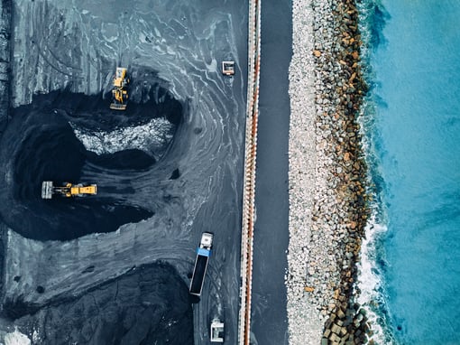
According to DEFRA particulate air pollution causes at least 40,000 deaths per year in the UK and costs the national economy £16 billion a year. The issue of urban air pollution in particular is recognised as a major threat to urban healthy living, with road transport and the combustion of fossil fuels the two leading sources of air pollution in urban environments. This project focusses on the first of these sources, pollution derived from road transport.
A study by the Healthy Air Campaign, Kings College London and Camden Council used members of the public to track air pollution levels in London. The study found that the cyclist was exposed to 50% less pollution than those travelling in a car on the same route and that cycling on a quieter route lowered pollution levels for the cyclist by a further 30%. The key to reducing UK air pollution lies with education and empowering the public to play a proactive role in reducing their own pollution footprint. Breathe Clean has been developed to enable near real-time air pollution and traffic data to be downloaded, interacted with and manipulated, so that informed decisions can be made to actively reduce air pollution levels in urban areas.
Breathe Clean is being trialled and showcased in Bicester for 2 weeks starting today (24th September) moving onto Belfast 2 weeks later. Geospatial Insight have developed the bespoke user interface and are currently in the process of optimising the app version of Breathe Clean allowing users to access air pollution data on the move.
Cllr Andrew McHugh, lead member for health and wellbeing, said: “The programme’s aim is to develop best practice to ensure health is at the centre of the built environment. What we learn in Bicester will inform the planning of new communities and improve health for generations to come.”
.jpg)